Being one of the first graduates of the Hetq Media Factory, I can safely say that I cannot imagine my journalistic activity without GIS technologies. We studied them for a semester, completed dissertations, the most attractive of which was to obtain surface temperatures of Armenia from American satellites. What did that information give us? We “only” found out that in the period from July 19 to August 13, 2017, an increase of about 13° C in the surface temperature was observed in the territory of the Republic of Armenia, following which the relevant bodies could have predicted the fire of “Khosrov Forest” state reserve.
Summarizing what data, sources and skills are in question, together with Stepan Khachatryan, a specialist in Geographic Information Systems (GIS) and water resources, we tried to give a description of the toolkit that is widely used in journalism and has just entered the Armenian media domain.
What is GIS?
“GIS is the science of ‘where.’ It is the synthesis of geography and digital technologies,” said Stepan Khachatryan.
Simply put, GIS is the same IT (information technology) field, to which we add the word geo, space.
According to Khachatryan, in order to better understand the roots of GIS, it is very important to study geography well as a pupil in school.
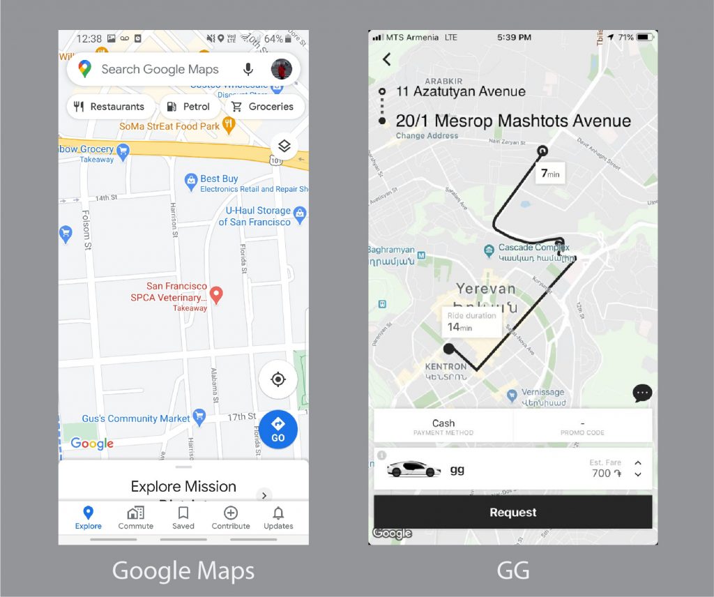
In everyday life, we use geographic information systems, such as digital maps (for example, Google Maps), taxis and all the services that are reflected on the maps.
“The interest in GIS has increased incomparably by almost all state structures,” said Khachatryan.
To date, these systems have been widely used and continue to be used by the Ministries of Environment and Emergency Situations. The expert believes that GIS is also a necessity for the Ministries of Territorial Administration and Economy (mostly in the field of agriculture).
“The cadastre must be based on the GIS system, which, as far as I know, is currently creating a unified cadastral system, which is hence integrated GIS and will contain the spatial data of the whole republic,” said Stepan Khachatryan.
What does GIS give to a journalist?
- visualization
First of all, it is a tool for telling a story through images. There are many, many computer design programs that get these images in case of long-term and repetitive work, which GIS does very quickly and automatically.
- opportunities to analyze
Sometimes the investigative journalist needs to draw his own conclusions from the collected data and see what connections are formed, what content can be seen, and not base things on other opinions.
- data collection
In the case of collecting most, if not all data the process is quite slow and difficult, and since it is not worth disposing of, journalists can collect that data in GIS and use it later.
- fact-checking
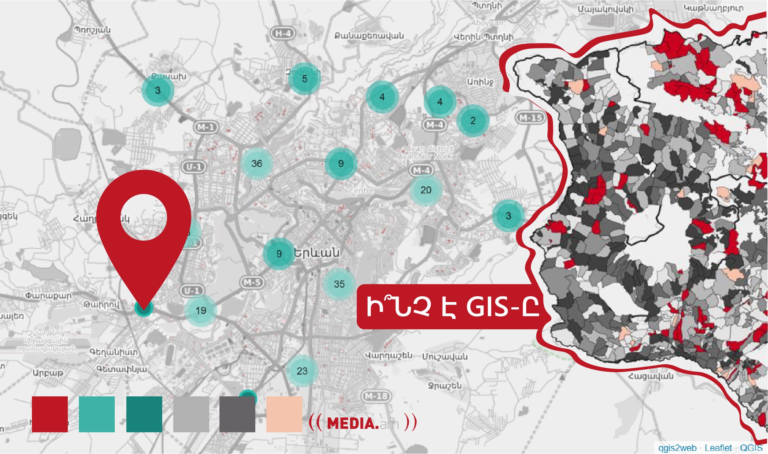
Often, government agencies publish data, the accuracy of which can only be discovered through GIS. For example, in one investigation, the Hetq Media Factory team discovered through maps that 97% of gas stations in Yerevan operate in violation of construction norms or fire safety rules, although the data provided by the Urban Planning, Technical and Fire Safety Inspectorate were different.
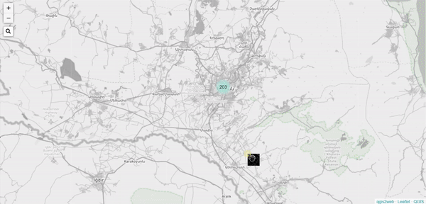
One of the most popular GIS programs is free qGIS and one of the most widely used commercial applications is ArcGIS.
GIS in the Armenian media
Teaching at the Hetq Media Factory was the first attempt to use GIS in the Armenian media, and according to Stepan Khachatryan, it was very interesting to see what opportunities this tool could create in this field.
“One of the best results was the research of the students of the Factory about the NA elections. It was of great public interest, which best proved that the use of GIS in the media field can have a long-term impact,” said Khachatryan.
In another article, the Factory compiled an interactive map showing the location, number and date of discovery of the remains found during the 2020 Armenian-Azerbaijani war.
In addition to teaching at the Factory, Stepan also provides professional advice to staff members of various media outlets with GIS-related questions, and given the number of such consultations, it can be said that the interest of media staff in this system has increased to some extent.
GIS in the international media
Geographic information systems are not new in the international media, it has strengthened its position in this field long ago. Major editions such as The New York Times and The Washington Post already have separate departments for data processing that allows for the most time-consuming sections to be done in advance and allow the media worker to avoid the process.
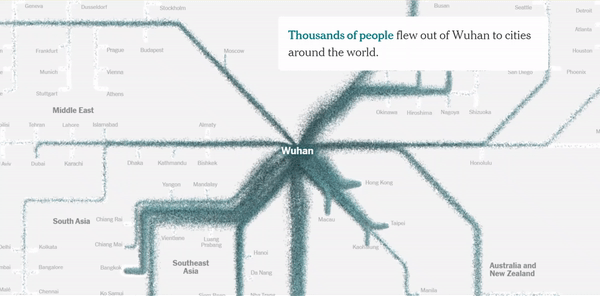
GIS is often used to cover COVID from different angles. On March 22, 2020, The New York Times published an article entitled “How the Virus Got Out,” in which a group of four journalists covered the movements of hundreds of millions of people, showing what became “the reason for one of the longest travel barriers in human history.”
Restrictions on emigration between the United States and Mexico were very important in the United States during the Donald Trump administration. In 2018, “The Washington Post” introduced the “invisible” crossing line of the official border through an interactive map.
The relationship between geographic information systems and local media is entering a new phase: This is now the second academic year at Hetq Media with new students studying GIS throughout the year to gain even more basic knowledge.
Christian Ginosyan