
Three months have passed since the catastrophic flood that took place in two regions of Armenia, Lori, and Tavush, which killed four people, partially or completely collapsed more than 20 bridges, and caused many other material damage.
The research of the Media.am fact-checking team showed that in several settlements located on the banks of the Debet River and its tributaries, construction norms are violated, and the norm of keeping a minimum distance from the river is not observed.
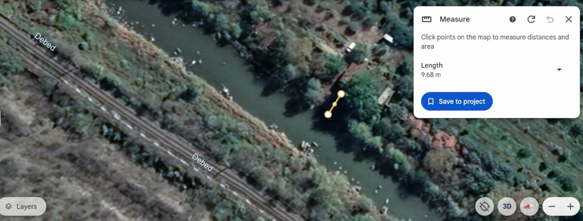
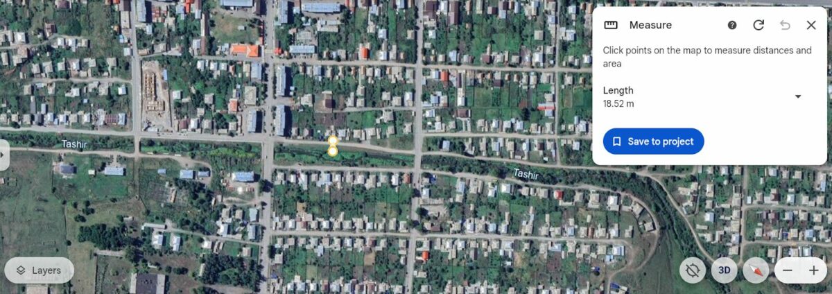
We did the research with the help of Google Earth, we measured the distance of the buildings from the river, and we tried to understand how much their number can increase over the years.
Development around rivers
Days after the flood, on May 30, Yeghiazar Vardanyan, the chairman of the Urban Development Committee, said that on average, apartment buildings should be 30 meters away from the river.
“For many years, if we are talking about apartment buildings, they have been built. 30 years and more. Maybe at that time, those norms were not as strict as they are now. For example, if I refer to today’s current norms, depending on the different flow and the power of the river, there are on average (+ -) differentiated approaches, a distance of about 30 meters should be ensured,” Yeghiazar Vardanyan said.
In addition to this report, we asked the Armenian Urban Development Committee to understand what norms apply when building around rivers. In response, the committee noted that the width of the inalienable zone of the rivers is 35 meters from the edge of the highest water horizon. This means that 35 meters is the mandatory distance to be kept from the edge of the highest water horizon when building around rivers.
In the case of recreation and sanatorium buildings, the mandatory minimum distance is 50 meters. Of course, the horizon of the river, from which the distance is calculated, can be different in every part of the river. The Urban Planning Committee told us about this in a verbal conversation.
According to the committee’s answer, the types of recreational activities, such as tourism, organization of rest and entertainment, fishing, hunting, picnics, swimming, sunbathing, walking, sports games, etc., are exceptions.
Alaverdi
One of the cities most affected by the flooding of the river is the enlarged community of Alaverdi. Due to the collapse of the bridge, a part of the city was isolated.
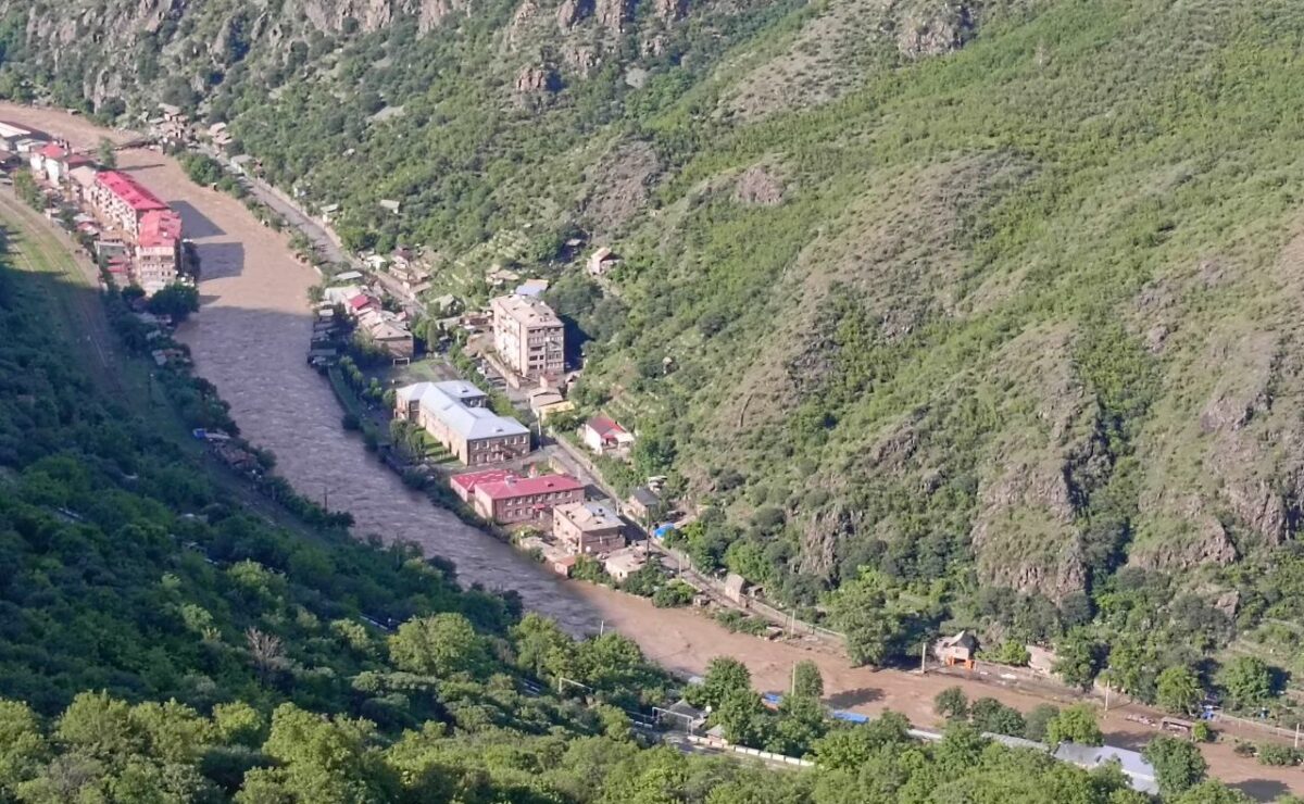
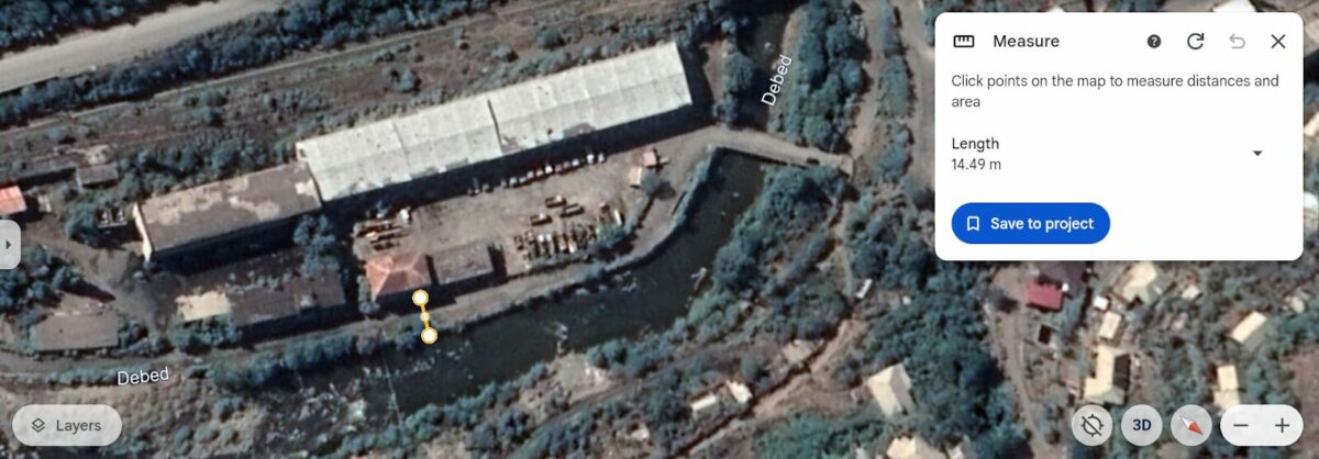
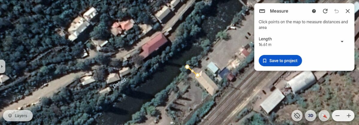
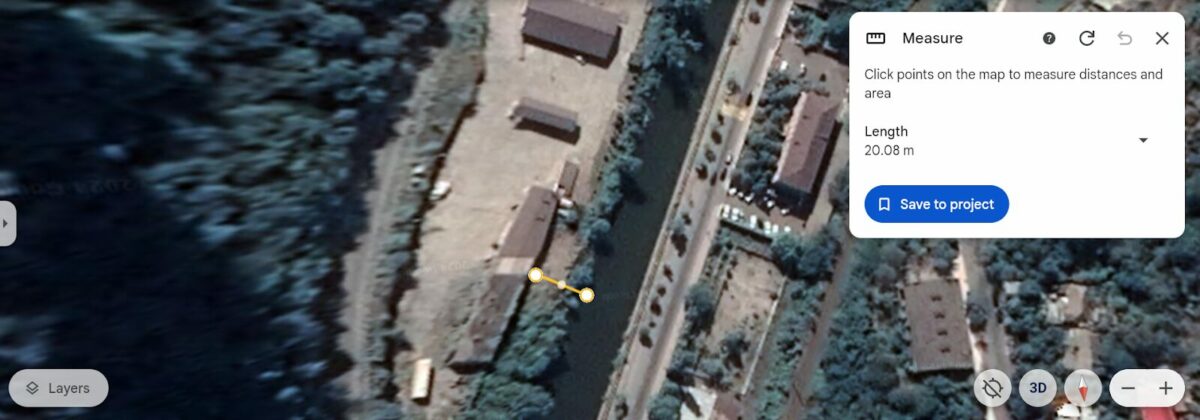
There are many buildings in Alaverdi that were built without maintaining a distance of 35 meters from the river. There are buildings whose distance is only 14, 17, 20 meters.
Some buildings were built without keeping any distance, directly at the mouth of the river.
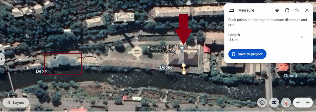
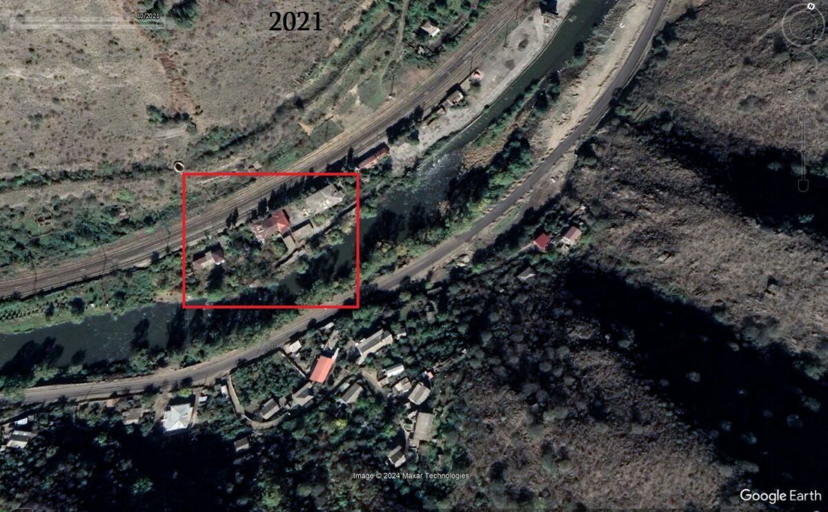
In this Google Earth image, you can also see Alaverdi Kindergarten No. 7, only 11-12 meters away from the river.
Note that the river bed has narrowed significantly in the section marked in red in the photo.
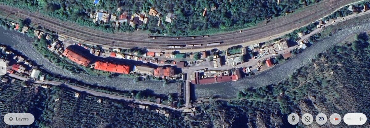
In Alaverdi, the district of Sanahin Station was the most damaged. Here, many buildings – houses and basements – were flooded.
There are, among them, apartments built on the banks of the river, in some cases 10-11 meters away, in some cases closer.
Akhtala
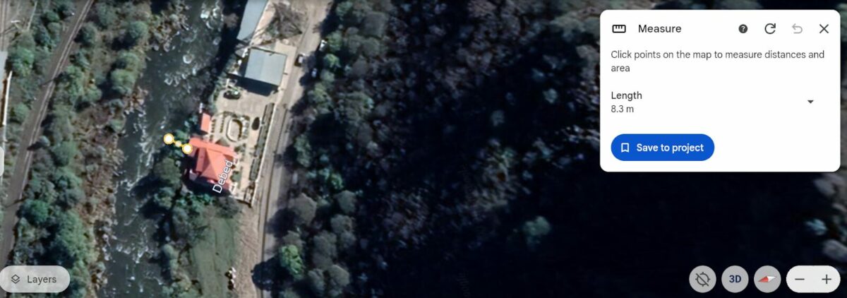
In Akhtala, there are buildings very close to the Debet river that do not conform to the norms that existed at different times. Their distance from the river is sometimes 8-9 meters, and sometimes some kind of distance is preserved.

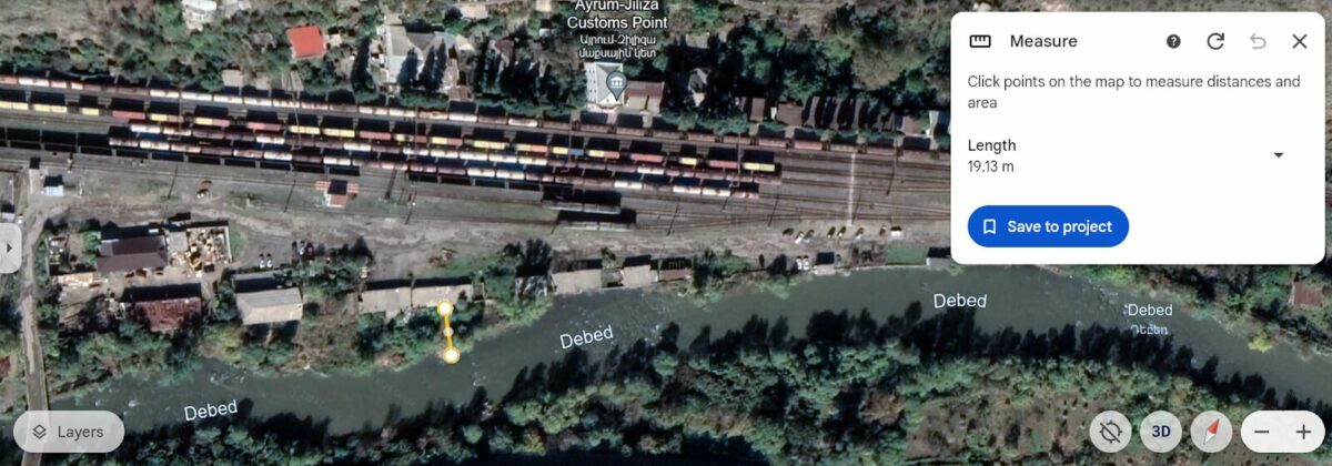
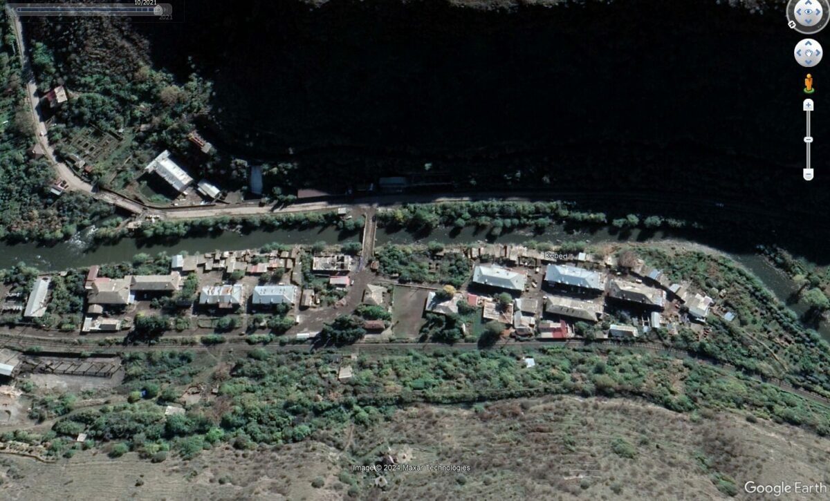
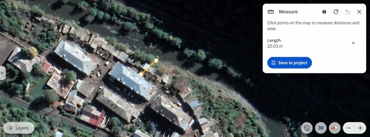
Ayrum
Ayrum is one of the most affected settlements as a result of the flood. There are many buildings near the river here. Some of them have a distance of 18-19 meters. Buildings built directly on the river bank can also be noticed.

Karkop
As of May 30, the settlement of Karkop was almost completely underwater. Minister of Territorial Administration and Infrastructure Gnel Sanosyan confirmed this information at the government session. According to him, the village was mostly flooded by one and a half meters or more.
As you can see, most of the buildings in Karkop do not have the required distance from the river. They are 9, 10, and 20 meters away from Debet, and sometimes no distance is maintained.
Vahagnadzor
In Vahagnadzor, it was also possible to find structures that did not have a distance of 35 meters from the river.
Note that some of them were built after 2007.
Tashir
The city of Tashir is one of the areas recognized as a disaster zone. The distance of many houses built here is 15-20 meters from the river.
What were the norms in the past?
In the course of our research, we have come across buildings built near rivers that were built during the Soviet Union, in the ’90s or early 2000s, when the rules for the location of buildings differed from the current rules. For that reason, we asked the Urban Development Committee for data on what changes the development norms have undergone over time.
In response, the department noted that until November 2014, depending on the length, the size of the water protection zones of the rivers was 15-500 meters from the source. In other words, 15 meters was the minimum distance where the construction of buildings and constructions, including residential buildings and recreation bases, was prohibited.
From November 13 of the same year, those norms were declared invalid, and new development standards were established, where, however, the restrictions regarding the inalienable zones of rivers, reservoirs, and other structures were not specified in such detail. The next change has already taken place in 2023. Now the minimum distance required, as mentioned above, is 35 meters.
In order to understand why the buildings in the Alaverdi community were built so close to the rivers, we asked the authority to issue building permits, in this case, the Alaverdi Community Municipality, to provide us with the basis of the building permits for a number of structures. In response to our request of June 6, on June 17 (in violation of the 5-day period established by the law), the municipal administration replied that due to the workload, they cannot provide the information at this time. A month later, on July 17, the Alaverdi municipality responded that we could get the information we needed from the Cadastre Committee’s archive files.
We did not ask the Cadastre Committee, because the grounds for the building permit are provided exclusively by the community government, so we again asked the Alaverdi community administration, this time reducing the amount of information to be asked.
On July 30, we received an answer from the municipality, where again we did not find the answers to the questions we were interested in. The community administration did not provide the basis for the building permit, but the ownership certificate numbers did not add any additional information to our study.
We again made a request to the municipal administration, formulating more clearly what information we need. As soon as we receive the answer, we will add it to the article.
The article was developed as part of the Investigative Media Lab’s project, with financial support from Journalism Fund Europe.